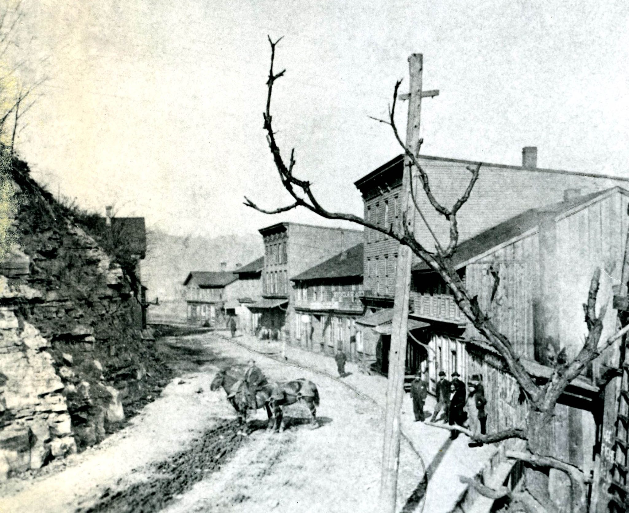
Oil City’s first street was Main Street, a six-block avenue that was also the settlement’s only street as oil speculators roamed the hillsides in 1860 just a year after Col. Drake’s successful oil well near Titusville.
It was described in an April 1865 edition of Harper’s New Monthly Magazine this way: “Oil City consists of only one street, winding down the west side of Oil Creek and the Allegheny River. It contains five or six hotels, all of which are crowded nightly with anxious oil seekers. All the business being done on one street, the town has a very busy look.”
The street ran between the Allegheny River and Hogback Hill. The first permanent settlers were the Halyday family from central Pennsylvania. Traveling to the area, they bought land in 1803 and laid out a farm.
Three decades later, Thomas Moran opened a hotel along the rudimentary road to serve the river barge oarsmen traveling south on the river.
By 1860, residential and business lots were being laid out along what would be known as Main Street. It would become the Third Ward when the City of Oil City was incorporated in 1871.
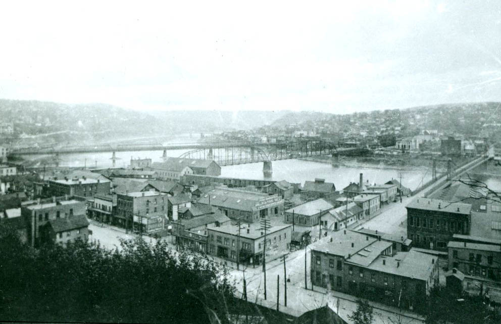
Main Street was the leading street in what would become the City of Oil City. This photograph was taken in 1861.
At that time, Main Street was described by city leaders as “a grand reflection of a city bursting at the seams” because of the flurry of business activity there. It would grow to be six blocks long and extend about half a mile from the Center Street Bridge to the city line and municipal incinerator, marked by a towering smokestack, along the river. At the Oil Creek junction, a livery stable, rooming house and undertaking business took up space by the late 1800s. At the southern end, ice houses and slaughterhouses, each a business that required a nearby water source, were in full swing.
The neighborhood was known for its ethnic diversity, especially its heavy Italian immigrant presence, its internationally known industries and its many historical quirks.
Three one-block streets extended from Main Street to the river’s edge. They were Relief Street, Hanna Street and Kline Street. Several wharfs were anchored in the river at those streets to serve the booming river traffic carrying timber, iron products, oil and more from communities up north to markets in Pittsburgh. Only Relief Street remains.
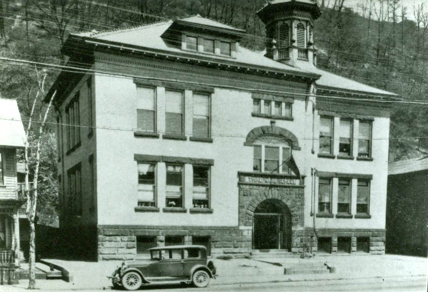
This 1930 photograph shows the Main Street Elementary School in the city’s Third Ward.
In testimony to what would become a bustling industrial corridor, nine separate railroad tracks paralleled Main Street and there were at least two railroad depots along the street.
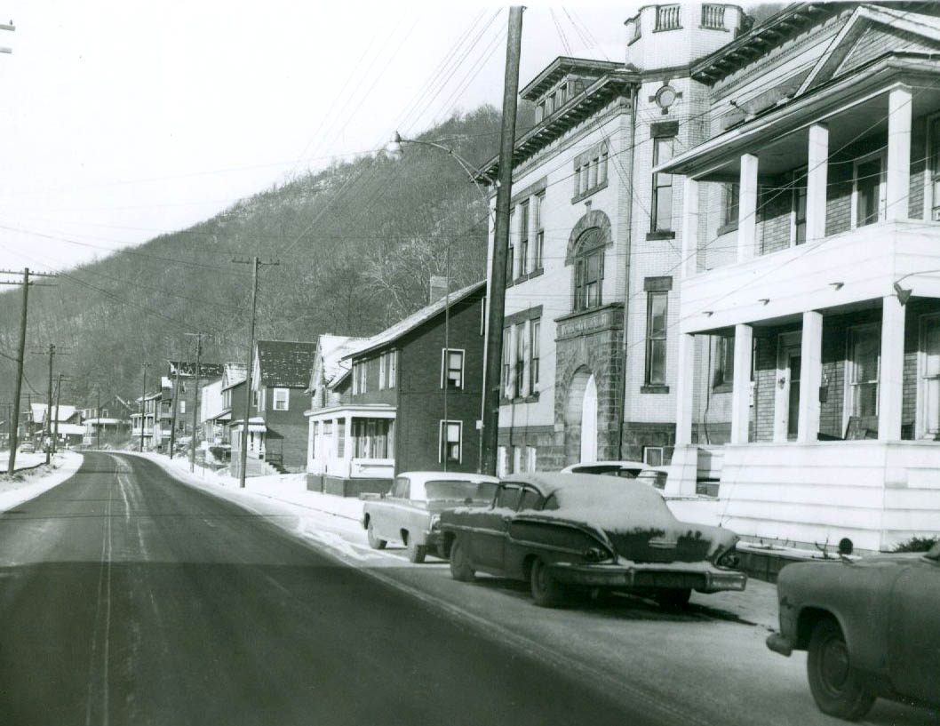
An imposing Main Street Elementary School, a two-story brick building, anchored the upper side of Main Street. Private homes extended out from either side of the school which served students from Main Street, Halyday Street and Hogback.
A New Housing Project
One of the city’s most ambitious residential housing plans was focused on the hillside overlooking Main Street. In 1872, oil men turned land speculators Thomas Porteous and Philo Clark drew up a design of dozens of tidy, rectangular lots atop Clark’s Summit.
The effort was prompted by an immediate need for more houses to accommodate the frenzied oil business. While a few streets – Tiernan, Dwyer and Cornwall – were selected by future homeowners, the remainder of the tract stayed unfilled as the newly opened South Side area drew most of the building activity.
This photograph, taken in June 1924, shows the aftermath of a deluge and mudslide on Main Street.
Third Ward Boasts Unique History
The neighborhood was home to world-famous industries as well as quirky elements that ranged from tunnel-boring to hotels and automobile sales.
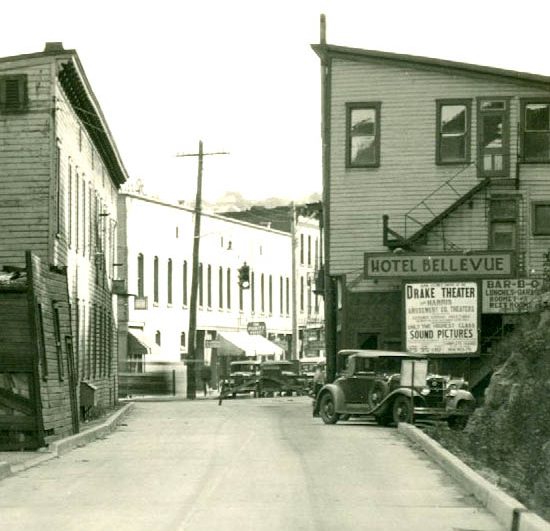
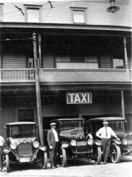
The Third Ward claimed the only hotel in the world that featured all front windows. Ripley’s Believe It or Not credited the Bellevue House on Main Street with that distinction. The hotel, situated across from the Center Street Bridge, was constructed against a hillside and was only one room deep.
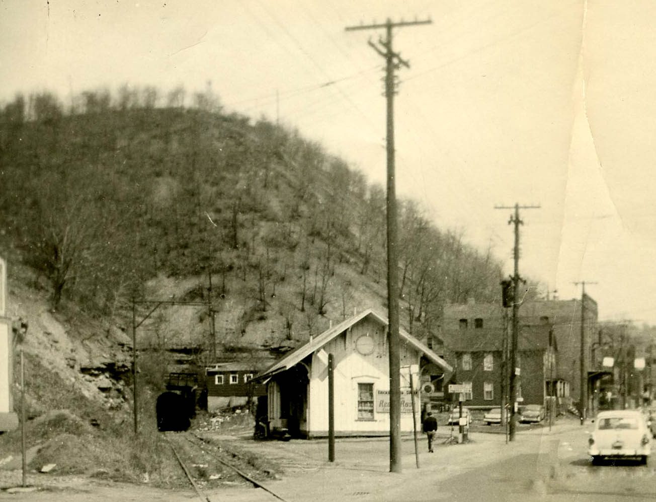
A 909-foot-long tunnel was constructed in 1869-70 at the base of Hogback Hill and just off of Main Street. Owned by the Jamestown and Franklin Railroad, it was bored through a hillside and that made it, according to the railway industry, the longest tunnel drilled through solid rock in the United States It was later bought by the Lake Shore and Michigan Southern Railroad. It was also used by the New York Central Railroad until officials closed one end of it for safety reasons in the 1960s. President Ulysses S. Grant’s train came through the tunnel while traveling from Titusville during a post-Civil War tour of the oil region.
The National Transit shops, a local business along Main Street that at one time employed nearly 2,000 people, is pictured in this 1917 photograph.
An incline railway, a system that featured two passenger cars drawn by cables and powered by steam, extended from Main Street to the top of Hogback Hill. Designed in part to serve the potential new housing units up above Main Street, it was in business only a few years. However, it was a popular venue as it transported residents to baseball fields and an expansive horse racing track at the top.
A huge swath of land between the river and Main Street was occupied by the sprawling National Transit Pump and Machine Company. The plant, which boasted more than 2,000 employees during the first half of the 1900s, made pumps, engines, fittings, drilling tools and more. Among its most notable products were pumps made for the new Panama Canal and pumps and engines used to open the vast Russian oil fields.
Two bridges connected the Third Ward to the South Side and one was especially notable. It was a suspension bridge, completed in 1876 by Roebling and Sons of New York City at a cost of $76,000. The company would later gain industrial fame as builders of the Brooklyn Bridge, also a suspension span.
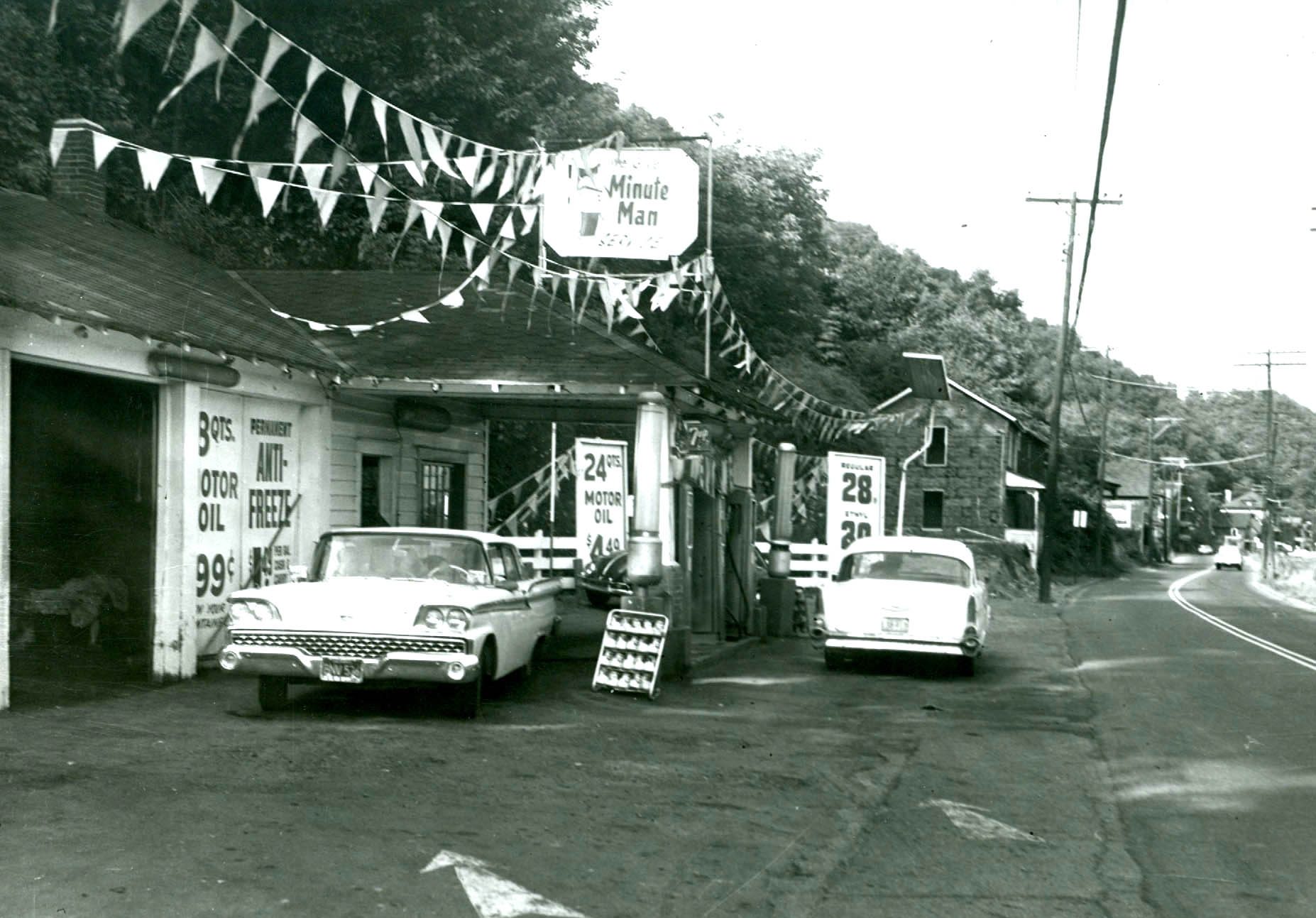
The Minute Man gas station on Main Street was one of several stations and garages along the street. This 1962 picture shows the station before a renewal project would result in its demolition a few years later. The price of fuel was 28 cents a gallon.
The world’s oldest Buick dealership once was at home in the Third Ward. In 1903, an auto repair shop owned by Curtis Weaver was expanded to include a department featuring the sale of new Buick cars. It originally opened on Elm Street but was soon expanded to fill a former bowling alley building on Main Street.
One of America’s top air aces worked at his parents’ grocery store in the Third Ward. Francis “Gabby” Gabreski, son of Stanley and Josephine Gabryszewski of Spruce Street, immigrants from Warsaw, owned the Purity Market on Main Street in the 1920s. Gabby was the top living U.S. air ace, a status achieved in World War II and Korea, at the time of his death several years ago.
The Third Ward was essential to the region’s rail traffic with various railroad company lines snaking up one side and the other of Main Street. A key station was located at the foot of Halyday Street.
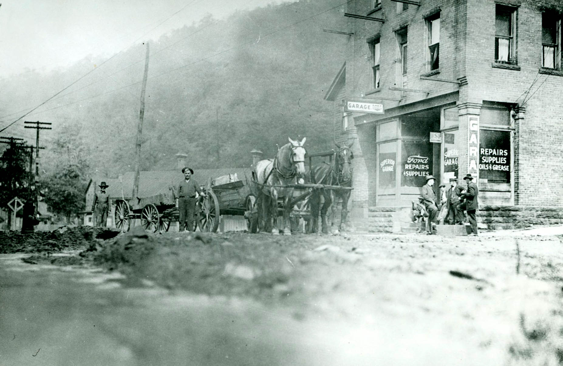
In the 1940s, Main Street flourished with more than 30 businesses and four dozen homes lining the busy thoroughfare. The business list included Pennzoil, Coreco, Sinclair, Sterling, Quaker State and other gasoline stations; Erickson’s Feed Store, Oil City Granite Works, Venango Ice and Coal, Petulla’s Photography Studio, dry cleaners and about 10 small grocery stores; building contractors, barbers, beauticians, a billiards hall and a harness-maker; restaurants that included the Square Deal, Drelick’s Deluxe Dinor, Kozy’s, Johnny’s Bar and Restaurant, New York Restaurant, Sumbar Restaurant, Main Street Dinor and Butiste’s; and many others.
By the mid-1950s, the neighborhood was a busy place but it was deteriorating.
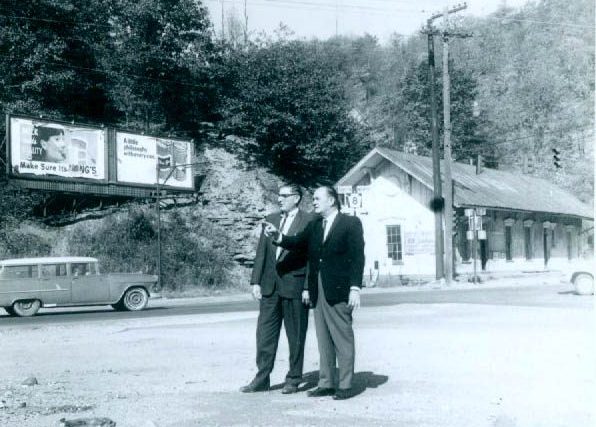
Oil City Mayor Raymond Anderson and city officials targeted the Third Ward for redevelopment in the early 1960s in what became known as the Gateway Urban Renewal Project.
Every building except a one-block stretch from Center Street to Relief Street, plus what is now the Electralloy (previously National Transit Pump and Machine Co. and later Worthington) plant, was razed.
The Route 8 section known as “the narrows” was widened and the soil trucked across Oil Creek to provide fill for a new Holiday Inn and Justus Park.
The New York Central Railroad passenger depot is shown in front of the railroad tunnel under Hogback Hill. President Ulysses S. Grant traveled by train through the tunnel when he visited the oil region after the Civil War.
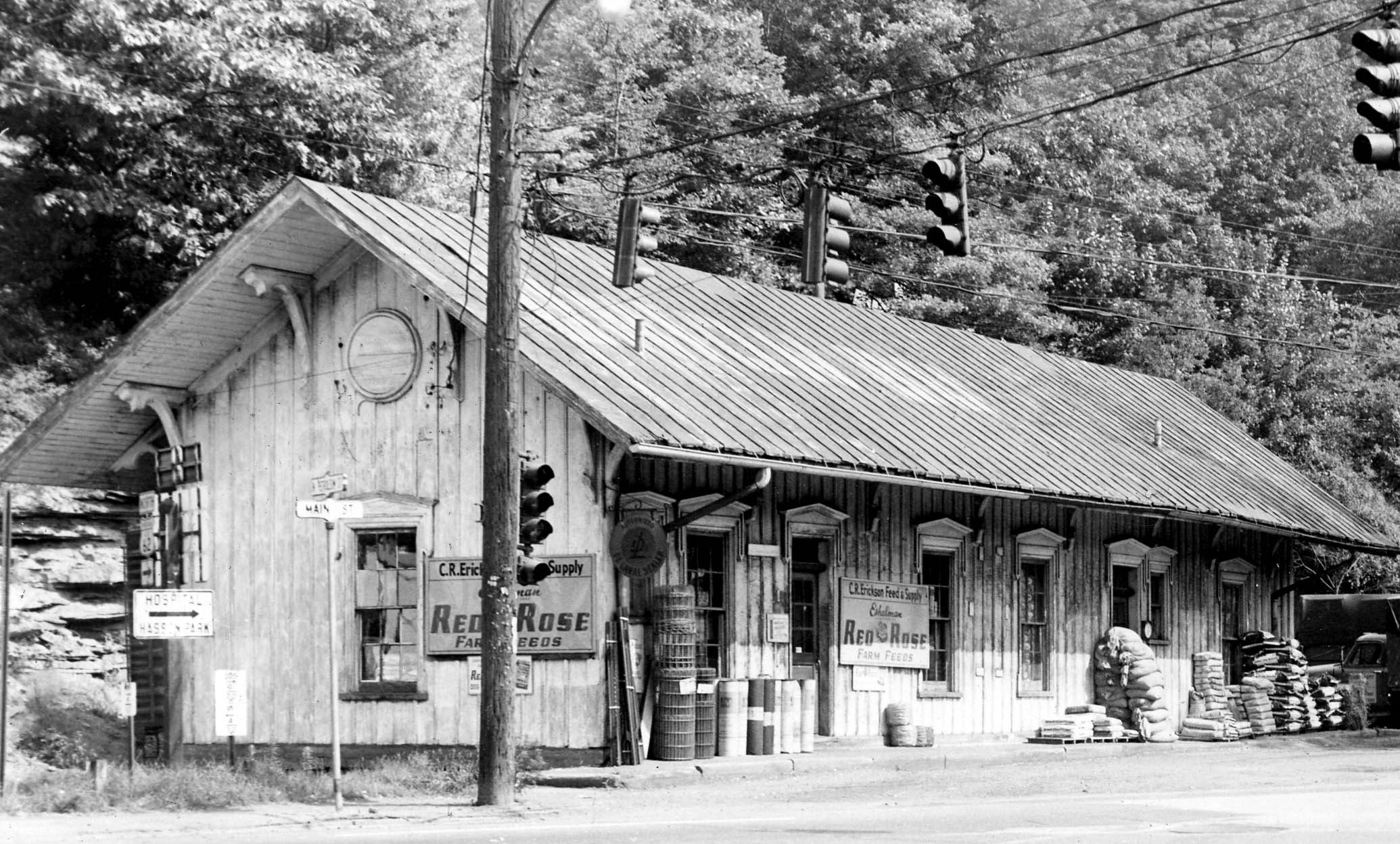
The railroad station on Main Street was converted to Erickson’s Feed and Supply Store in 1950.
Oil City Mayor Ray Anderson talks with Gene Hondel, a city employee, on Main Street just prior to the city’s extensive redevelopment project that razed most of the buildings in the Third Ward.
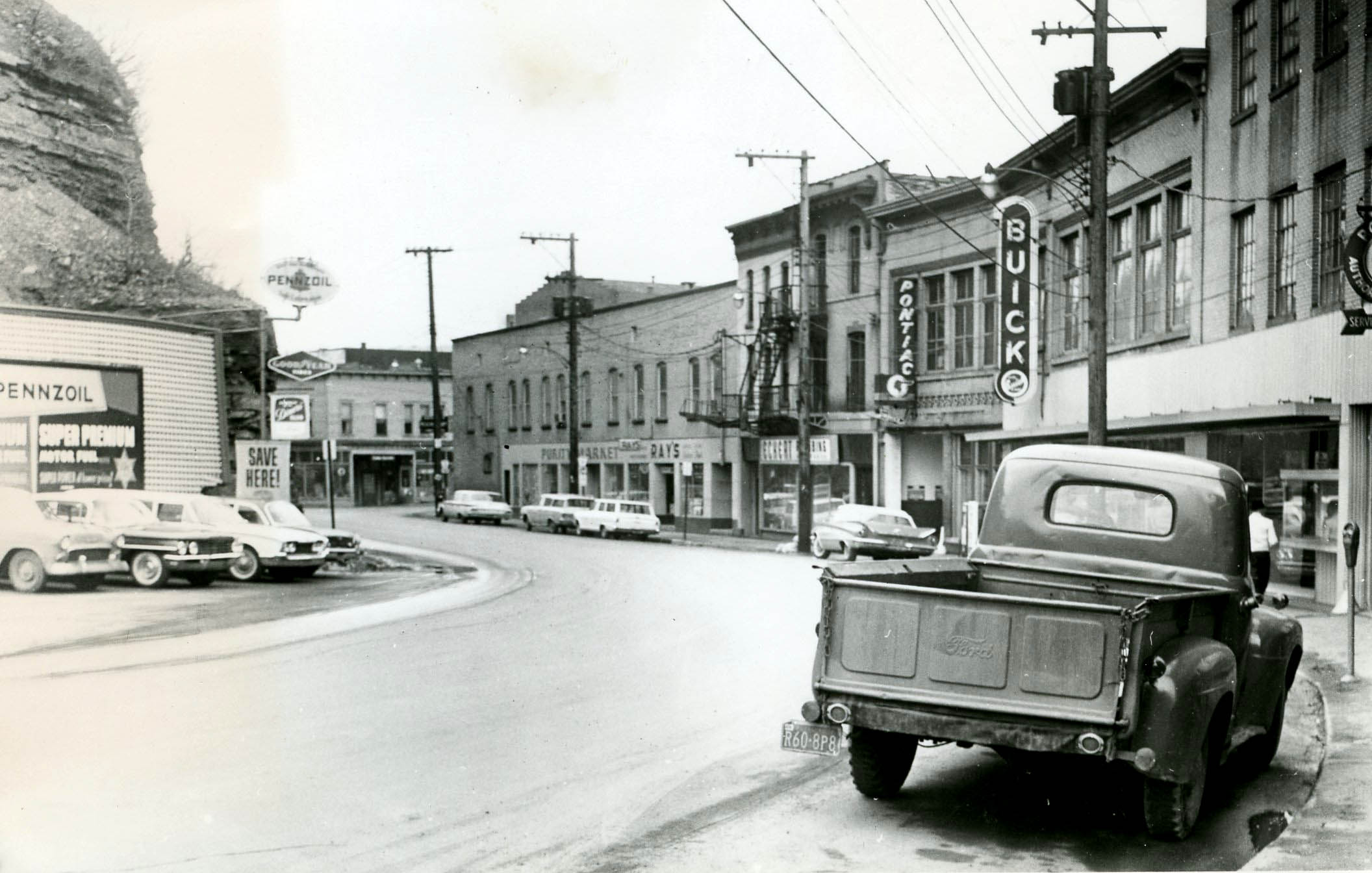
The two-story Gabreski building anchored the end of Main Street at the intersection with the Center Street Bridge. It was destroyed in a fire in 2004. This early 1960s photograph shows Corrin Electric, Purity Market, Ray’s, Eckert Plumbing, Weaver Buick and (on the left) Irwin’s Pennzoil gas station.
Oil City bridges are prominent in this 1902 photograph taken from Clark's Summit. They are the Relief Street Bridge, the suspension bridge and the Oil City & Petroleum Bridge. A portion of the sprawling National Transit Pump and Machine Shop is visible on the right.
The Main Street school is prominent in this line of structures along Main Street. Residences as well as small shops were located along the city street.
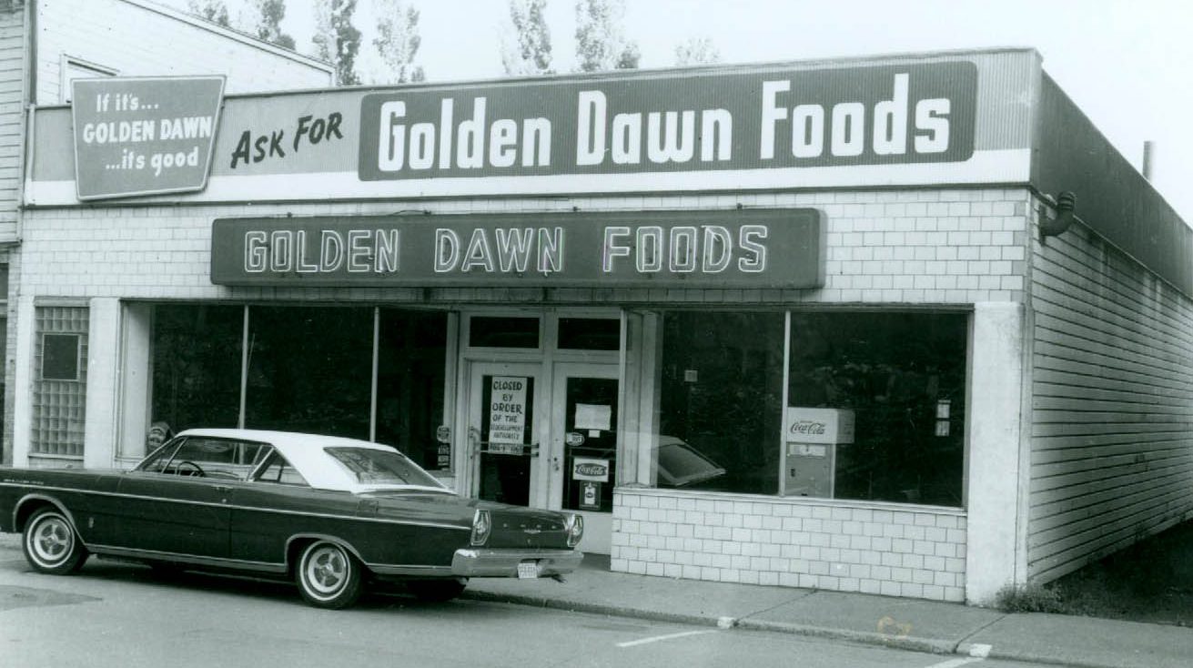
Main Street boasted several small mom-and-pop grocery stores with the largest one being the Singer’s Golden Dawn Store.
The side of the Bellevue House is shown as the entranceway to Main Street. The hotel advertising includes barbeque lunches and rooms while the Drake Theater poster offers “only the highest class sound pictures.”
The Whitehill Taxi Co. had an office in the Bellevue House at 8 Main Street. This photograph was taken in 1922.
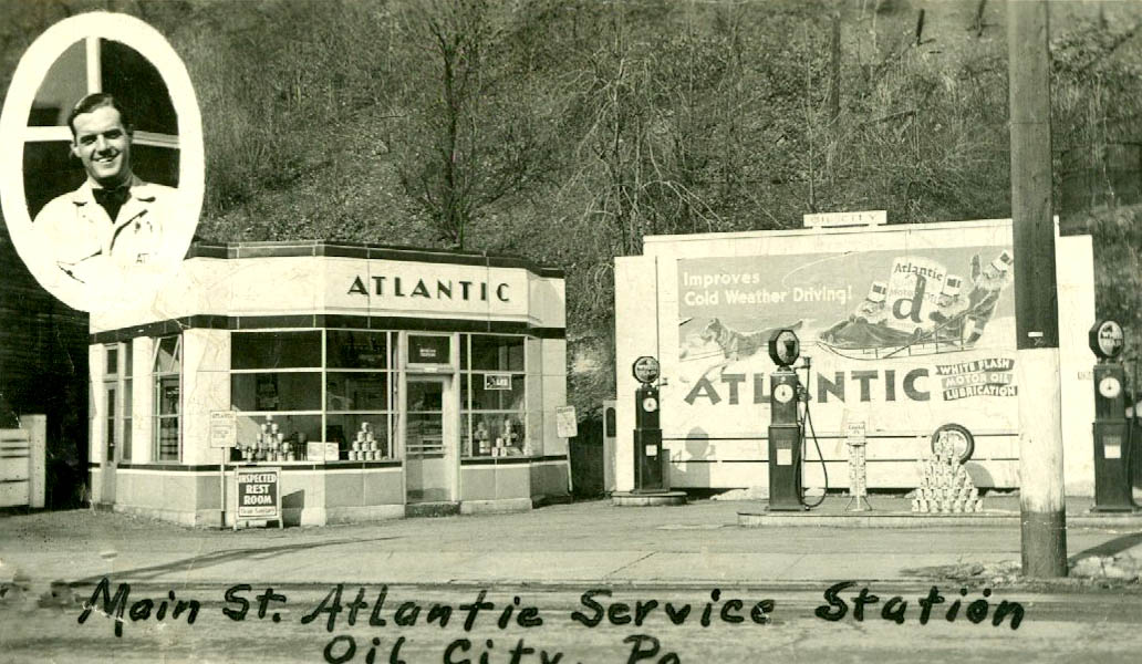
The Third Ward listed several gasoline stations. The Atlantic station is shown in this 1940 photograph. Austin VanKirk is shown in the insert.
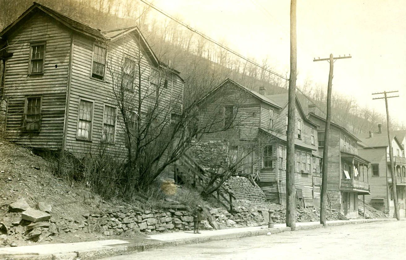
Homes were nestled up to the hillside along Main Street. The neighborhood boasted a hearty ethnic heritage with a large portion of the residents claiming Italian roots.
Written by Judy Etzel with research by Kay Dawson and design by Natalie Cubbon.
HIDDEN HERITAGE IS SPONSORED BY:
Jack Eckert & Susan Hahn
— In Memory of Carole Eckert —
Support This Project
Donations to the library are appreciated to help offset printing costs & make this project possible! Want to become a sponsor? Email us at promotions@oilregionlibraries.org to get started!